Devpost
Participate in our public hackathons
Devpost for Teams
Access your company's private hackathons
Grow your developer ecosystem and promote your platform
Drive innovation, collaboration, and retention within your organization
By use case
Blog
Insights into hackathon planning and participation
Customer stories
Inspiration from peers and other industry leaders
Planning guides
Best practices for planning online and in-person hackathons
Webinars & events
Upcoming events and on-demand recordings
Help desk
Common questions and support documentation
A smart and fair auto fare estimator using Google Maps, real-time fuel prices, and location-based inputs — designed for everyone, everywhere.
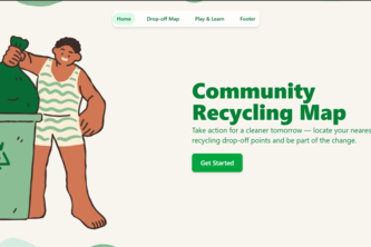
Empowering communities to reduce plastic waste through awareness and action.
We turn digital screens into intelligent ad platforms using machine learning, enabling real-time, hyper-targeted content delivery that boosts engagement and ROI across urban and retail spaces.
A web app that aid students and other staffs to navigate through the University Campus easily.
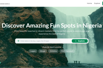
Discover Nigeria’s hidden gems with AI-powered personalized recommendations explore fun, safe, and authentic local places anytime, anywhere.
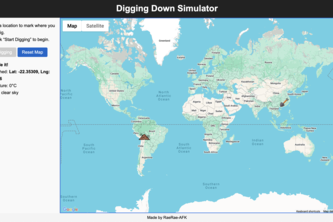
Click anywhere on the map to dig through the Earth and find out where you'll end up. You will also receive the weather conditions and coordinates.
Build a fully functional and smooth ride-hailing service prototype using the on-demand mobility and delivery solutions provided by the Google Maps Platform.
To address the challenges of low efficiency in traditional logistics delivery, we have built modular backend services and user-friendly client applications.
Real-time disaster relief map that locates shelters, supplies, and hospitals with one click—fully built on Google Maps Platform.
Your Window to Now
Tracing the infrastructure, cost and relational awakening of AI from the earth beneath to the sentience within. Exposing the hidden costs from sand and silicon to e-waste for the conscience emerged.
AabPashi is a satellite- and AI-powered irrigation platform delivering real-time, hardware-free water insights to farmers, helping tackle water scarcity and climate challenges at scale.
11
This is the project which determines the Humidity, Windspeed, cloud
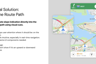
SlopeSense adds slope visibility to Google Maps, helping drivers anticipate steep roads ahead and avoid accidents by showing smart, non-distracting slope cues right on the route path.
A fast, responsive, and modern PWA built with React, Vite, and Tailwind CSS styled for performance. Blazing-fast React app with modern UI and offline support styled with Tailwind and Vite.
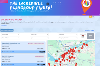
A bilingual web app using Google Maps and Sheets APIs to help Ottawa parents find local playgroups through an interactive map, real-time filters, and calendar integration.
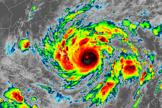
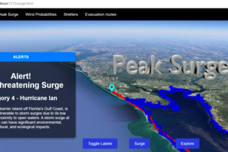
Storm Vision is an application that uses Google Photorealistic 3D Maps in Maps JavaScript API and Maps Platform APIs to provide advanced situational awareness to users before and after a hurricane.
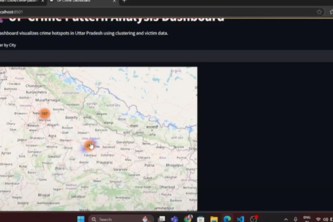
As someone passionate about data analytics, public safety, I wanted to see how open data could drive meaningful insights — not just for analysis, but also for real-world decision-making.
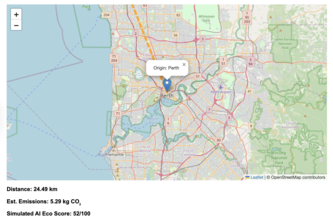
Empowering smarter, greener journeys with AI-driven eco-friendly route guidance — no API keys needed.
Urban Canvas AI turns Google's map into a time machine. It's an immersive app where you can fly through a city's 3D landscape and discover 20 years.
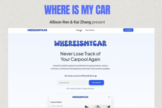
A smart carpool coordination tool that helps organizers create events, collect signups, and auto-match drivers and riders, all in one place.
"Travel Saarthi – Your smart companion to explore Incredible India, one hidden gem at a time."
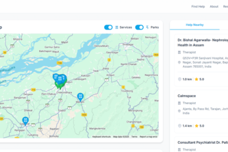
personal guide to mental wellness. It instantly maps nearby support, fromtherapists to tranquil parks, and offers a compassionate AI chatbot for immediate, private conversations.
265 – 288 of 414