Devpost
Participate in our public hackathons
Devpost for Teams
Access your company's private hackathons
Grow your developer ecosystem and promote your platform
Drive innovation, collaboration, and retention within your organization
By use case
Blog
Insights into hackathon planning and participation
Customer stories
Inspiration from peers and other industry leaders
Planning guides
Best practices for planning online and in-person hackathons
Webinars & events
Upcoming events and on-demand recordings
Help desk
Common questions and support documentation
An AI-powered wearable with a dedicated app, empowering visually impaired individuals with enhanced mobility, safety, and independence for a world without boundaries.
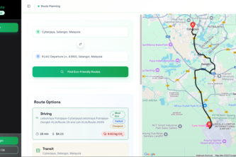
EcoRoute helps you plan trips by comparing transport modes based on emissions, cost, and time—making green travel easier, smarter, and more rewarding, every day.
One Tap Away from “You're Gonna Be Okay.”
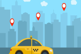
Faster rides, live routes, seamless pay — all in one app.
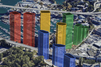
See the Senakw Project on a Photorealistic 3D Map. Discover the project's scale, potential sightline changes, and what it means for local residents living in Vancouver, Canada.
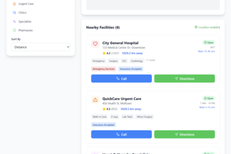
AI-powered platform that routes emergency vehicles faster and alerts the public in real time using Google Maps Platform.
MapThat lets users pin and filter personal experiences on Google Maps—like events, gyms, restaurants, or nature spots—creating a map of memories and discovery.
Multi Vehicle Route Optimization Platform for iJooz
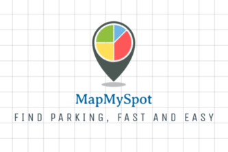
Tired of wasting time hunting for parking? MapMySpot instantly shows you open spots—whether it's a garage, lot, or street parking. Find Parking fast and easy!
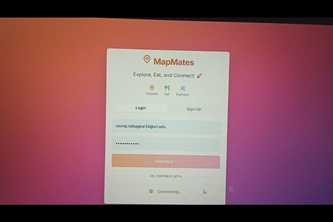
"MapMates – Where places come alive and strangers become friends."
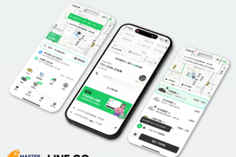
LINE GO leverages Google Maps Platform to deliver 20% more accurate ETAs, 30% fewer fare disputes, and 90% fewer dispatch delays—bringing unprecedented convenience to Taiwan’s mobility ecosystem.
An interactive atlas for the modern era.
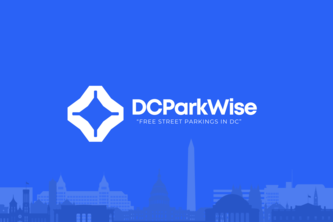
DCParkWise – Find Free Street Parking in Washington, D.C. Instantly
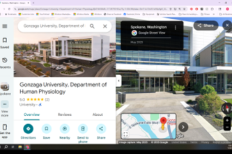
Gonzaga’s Human Physiology Department now features updated 360° Street View, immersive lab tours, and accurate business info, reflecting our new building completed in 2022, replacing outdated views
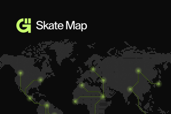
Ultimate gamified platform for empowering x-treme sports enthusiast to explore new places, film new tricks, and connect with a more inclusive global community.
Every 2 seconds, someone dies from a preventable disease. CardioGlimpse uses AI to detect, triage, and guide you—before it's too late. It’s not just tech. It’s a global lifesaver.
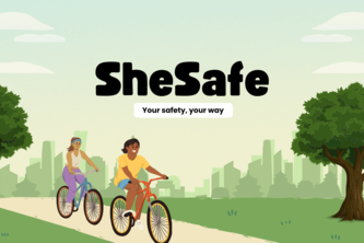
SheSafe is a safety-first route-finding platform for women, helping them find the safest and not just fastest route when traveling or relocating, with AI tips, weather, and safety insights.
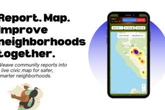
Weaving community reports into a live civic map—capture locations, report issues, and sew together brighter, safer streets.
Rwamoto helps tourists and foreigners get accurate motorcycle taxi prices in Rwanda, supporting government efforts to increase fairness, transparency, and trust in local transport.
11
Business Mapper
Let us take you places
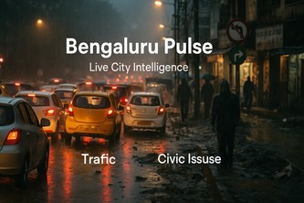
Bengaluru Pulse – AI at the Heartbeat of the City Real-time alerts, mood mapping, and predictive insights for a smarter Bengaluru.
BluePaw is a mobile app that connects dog owners and professionals. Discover nearby dogs, plan walks, find lost pets, and build localized communities of pet lovers and experts—all from your phone.
241 – 264 of 414