Devpost
Participate in our public hackathons
Devpost for Teams
Access your company's private hackathons
Grow your developer ecosystem and promote your platform
Drive innovation, collaboration, and retention within your organization
By use case
Blog
Insights into hackathon planning and participation
Customer stories
Inspiration from peers and other industry leaders
Planning guides
Best practices for planning online and in-person hackathons
Webinars & events
Upcoming events and on-demand recordings
Help desk
Common questions and support documentation
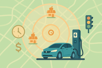
Plan green routes, save CO2, earn badges with Google Maps.
“AgriRadar is a smart, interactive farm map that shows crop type, moisture, and health — helping users monitor fields visually for better, sustainable farming decisions. 🌾🗺️💡
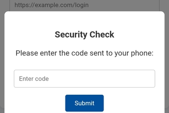
An application that detects pishing emails or website
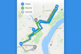
What if your map could think ahead — and keep you safe? A strategic safety layer designed for future-ready navigation to build safety into every route for every single person in the world.
Swipe your way to the best local eats! Our app helps tourists discover hidden gems and popular spots no lists, just fun, photo-rich cards powered by Google Maps and authentic reviews.
ศิลปะแผนการการจัดวางตำแหน่งที่ตั้งของที่อยู่อาศัยและอื่นได้อย่างแม่นยำการศึกษาและพัฒนาระบบบริหารการเดินทางการสำรวจความต้องการกำหนดตำแหน่งการประกอบกิจ ติดตาม สำรวจ แผนการ เรียนรู้ ผลรับที่ชัดเจน
This tool shows which grocery stores people can reach using shared mobility services like carsharing. It helps shoppers plan trips and helps cities identify areas with limited grocery access.
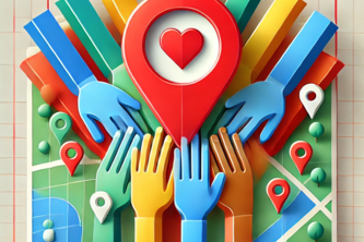
Volunteer here, volunteer there, volunteer anywhere with Google maps
CulturAtlas – Mapping Endangered Traditions to Preserve Global Heritage Through Geospatial Memory
Jansahay – Report. Resolve. Reform. A smart civic issue platform empowering citizens to report problems and enabling authorities to respond efficiently with real-time AI tracking n and data insights.
GeoPulse leverages the Google Maps Platform to deliver real-time, AI-powered location analytics for city planners, emergency services, and businesses—empowering data-driven urban transformation.
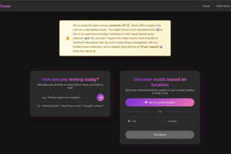
Using Google Maps' reverse geocoding, our project converts lat/lon to city/country, fetching location-based music.
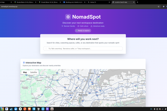
NomadSpot maps safety and nearby essentials around any address. Just enter what you need like gyms or restaurants and we’ll show what’s nearby and highlight areas to avoid.
Memory Mix lets you upload, organize, and explore your photos on a 3D map, using the Places API to predict locations you've visited, and creating a visual journey through your memories.
Advanced Geopolitical Strategy Game
Our project turns Google Earth into a virtual drone experience. Whether you're planning your next drone flight, creating an immersive tour to showcase your Airbnb, or just exploring the world.
3d campus tour experience
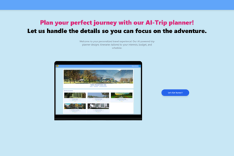
"Plan smarter, travel better — AI-powered personalized trip planning in seconds!"
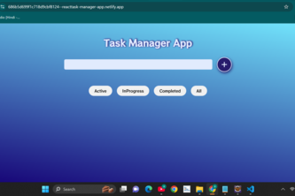
This is a beginner-to-intermediate level ReactJS project that helps users: ✅ Add new tasks ✏️ Edit existing tasks 🔁 Update task progress (e.g., Not Started → In Progress → Done) ❌ Delete tasks
Humanly takes care of a person's (especially women's) safety with the help of volunteers nearby. With humanly, we empower anyone willing to contribute and make a change in society using technology.
A map-based tool to help students and visitors find key campus locations easily.”
11
Empowering future-ready learning with AI-driven insights, personalization, and innovation. NextGenEd: Shaping Minds with Smart Tech. NextGenEd: Where AI Meets Smarter Education.
fluffi intelligently revives your past using Maps APIs, semantic embeddings, and geofencing logic.
361 – 384 of 414